Thursday, September 18, 2008
You don’t miss the water till the well runs dryI wonder if people in the wealthier worlds would appreciate their unsupportable water practices (personal, agricultural, industrial) if they went for 2 summer months without running water: buying drinking water or loading up at friends’ homes, borrowing washing machines or using public Laundromats, borrowing showers and re-learning how to sponge bathe, and loading up gallons of nearby lake water for the toilet and a few precious plants while watching the fruit trees crisp in the summer heat. More to the point, I wonder if people (myself included, even after these aforementioned 2 months) would change their practices if they really and truly got it that inexpensive access to seemingly unlimited water resources is a dream and that we are in the process of slowly, painfully, waking up.
Just do a google search on global water shortage or something like it. This is not new news, but it is a dream from which we do not want to wake.
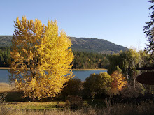
The following chronicle was originally written to clarify my thinking about the geology and groundwater access in the area in which I now live, as a result of a deep (422’) new well being drilled on my new property. But it is becoming more than that. It is becoming something of a document to share via this blogsite, and perhaps also by ‘letters to editors’; and more importantly, it is becoming the foundation of a desire to offer my services as a geologist to the population where I now live, so that we can all become more educated in this regard. As you’ll see below, this is an area where lakes and rivers abound in a semi-arid climate, so in the same way that the deeper local groundwater issues are obscured by a wealthy water-based tourism, the vastly deeper global water crisis is obscured by our collective, Canadian, relative wealth.
Wednesday, September 3, 2008 – Thursday, September 18, 2008
1. I moved into my newly purchased little house on 0.99 acres above White Lake on July 12, 2008. I had opted not to have the water in a shallow well (about 25 feet) checked for quantity and quality, as I had heard from the previous owner via the realtors that he had never run out of water. But I'd also heard from a neighbour that previous people at the house (who were irrigating the garden) had run out of water in past years. So I knew there could or would be issues, and I decided not to spend the $1000 or so for inspection, and just deal with a problem if or when it occurred, though I could not anticipate that it would occur as seriously or as suddenly as it did! However, that is still my caveat emptor.
2. Had I had it inspected, and had the inspector advised me that 2 weeks after moving in that the shallow well would be dry and that a month later I could/would be having 422' drilled to the tune of $16,000 (no estimate yet on pump installation) I would have sought a lower purchase price. That lower price may not have lowered my down payment much, though the mortgage would likely show a small reduction. Thus my current situation of the cost of the new well and pump could be the same as if it had been inspected...
3. The shallow well obtains surface water infiltrated from beneath the little stream on the property. When it went dry at the end of July, I began talking with other folks in the area, especially the neighbour who helped me by arranging to have 4000 gallons dumped into that well with the local fire truck. In those conversations I heard that water shortages even with deep drilled wells in the area were commonplace.
4. Finally, there is the possibility that no-one, not even an inspector, may have been able to anticipate that the shallow well would leach its water back into the soil once it (the soil) had become dry and the stream had dried up. This I saw for myself in the 3 instances when water was pumped in (4000 gallons in 3 increments in a 10 day period), and I watched the level drop by several hundreds of gallons in a matter of a day, with no usage but some toilet flushing!
5. In all this time, my training and experience as a geologist was on high alert: I could see on nearby White Lake road that the bedrock was a relatively thin-layered metamorphic rock that extended many dozens of miles north, east, and west of here. I anticipated that it would not be difficult drilling (in contrast to granite, for example), and in fact at about 100’ down, the driller told me it was called a “soft rock” by drillers.
6. The “overburden”, like that of much of the region here, was glacially produced; in this case unsorted till from the lateral moraine of the glacier that formerly occupied the White Lake valley. In other locations, delta sediments show where former rivers were draining into the glacier-filled valley; this is not the case on the hillside on the north side of White Lake valley where I live. Once the drilling started, the overburden was found to be about 22’ deep which surprised me at first, having thought it could be closer to 50’ but I’d done no study to determine this, it was just a guess. But there is a small stream that runs through my property, from NW to SE, and though I have not seen it run when fully fed, such as in the early spring, I expect that it might die out completely not far below my property line. I have yet to look for a possible drainage site where it runs into the smaller of the two White Lakes immediately south of me, but will do so soon. But as I looked at the ravine that occupies about ¼ of the west side of my sloping property, it is far wider than the stream would warrant, so I figured that in post-glacial times, it was a much larger drainage system and could have scoured off some of the overburden in this spot.
7. The drilling then proceeded through 400’ of greenish-black, crumbly bedrock, possibly green from chlorite, indicating this was a low-grade metamorphosed former seabed, looking somewhat like phyllite in places, the original sedimentary rock being possibly Paleozoic in age (TBD)? At various depths, the flow of water into the well was tested, and found to be about ¼ gpm at 320-360’, then ½ gpm at 360-400’, then finally ½ gpm at 422’ before pressure fracturing. As of this writing, with no pump in the well, we do not know what its recharge rate will be. The pressure fracturing opened the rock enough for 1200 gallons of injected water to rapidly disappear from the pipe, and the experienced drillers were confident that the recharge rate would then be better than ½ gpm.
8. I had made a fundamentally erroneous assumption when I saw this metamorphic bedrock in thin (up to 3” thick) schistose layers. I not only assumed that it would be easy drilling, but I assumed that the recharge rate would be higher than ½ gpm (not quantitatively, just hoping!). Finding that wasn’t the case, and recalling that that people in this area frequently had water problems opened my eyes to the broader region…this bedrock may simply have very low/slow permeability!
9. My land is at about 1598’ elevation where the well is (need to measure for sure, using GPS?), and the average elevation of White Lake is about 1530’, thus it seemed reasonable to expect that the water table under my land is at about, or less than, 70’ deep. The driller estimated a static water level of 100’, so that may be consistent with a lower current lake level at the end of August. Again, in my hope and quasi-naiveté, I’d assumed that the driller would not have to go much beyond the water table to find a flow sufficient to stop drilling (and stop the financial hemorrhage that I was certainly anticipating!)
10. This region is rich with lakes and rivers; it is also a semi-arid climate with normal snow levels of 3-6’ (to be verified) of snow in the lower elevations, and deeper snow forming the snow pack on the peaks. This snow pack melts in the spring, filling the rivers and lakes to capacity and causes frequent low-land flooding. And yet 3-4 months of mostly dry summer follows, and the wells on the hillsides dry up. So what is the overall groundwater picture here?
11. Mountains of metamorphic bedrock are incised by rivers and lakes with flood plains and some marshes, respectively. Lower slopes of the mountains are mantled by glacial till (lateral moraines), and in some cases, pro-glacial sorted sediment. Where are the wells that run dry? I’m going to guess that they’re like mine, on the hillsides. One well high above my place is 700’; the one next door but one property is 350’ and is slightly higher on the slope. Depths of wells themselves do not indicate the elevation of the water table of course, but the well logs may, or should, reveal this level, and this is what I would like to pursue.
12. New information came from my conversation with the pump installer…saying that people at the NE end of the White Lake valley do not have as frequent low-water experiences as those at the opposite end, where the valley empties into the broader valley containing the Trans Canada Highway. I am at the end of the valley near the highway. But I recall that as the northern end of the White Lake Rd loop climbs the north side of the valley slope, the bedrock changes from an approximate westward dip, to an eastward dip. And if that trend continues, underlying the hill/mountain toward the far NE end of the valley, then the impermeable bedrock may be trapping water between its layers, and allowing it to run down-dip. So I am somewhat high and dry in more ways than one!